|
Rattlesnake Rec Area
| Click on map for larger view |
|
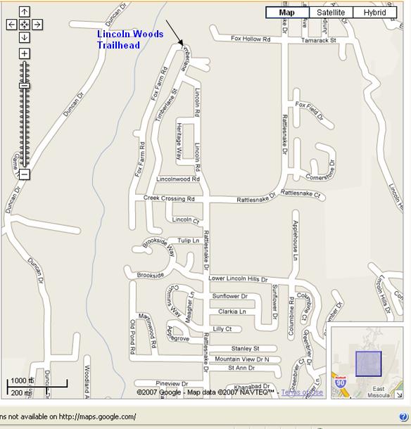
| We meet at the trail head parking lot. Turn left off of Rattlesnake Dr. onto Sawmill Gulch Rd. |
| Click on map for larger view |
|
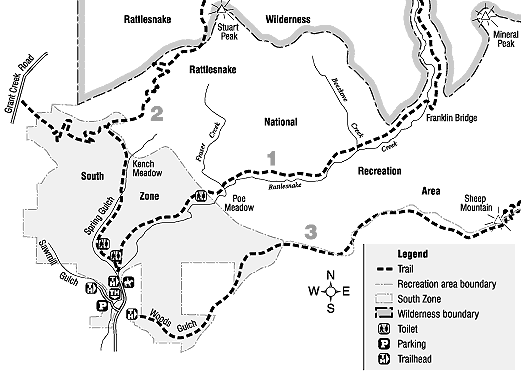
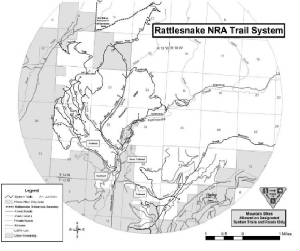
| Rattlesnake Map 2 |
Info:
With the major trailhead only 4.5 miles north of Missoula, the 61,000 acres of glaciated topography in the
Rattlesnake Wilderness and National Recreation Area (RWNRA) form Montana's premier urban wilderness, blending the best of
both wilderness and civilization. The U-shaped Rattlesnake basin is fed by more than fifty small creeks that begin as seeps
from springs and melting snowbanks in the upper Wilderness portion of the NRA. Resting in the more than thirty high mountain
lakes, crystal clear water then plunges down waterfalls to hanging valleys separated by sheer headwalls and carpets of sub-alpine
fir, lodgepole pine, and spruce sloping down to open Douglas fir and ponderosa pine parklands.
The non-wilderness
(yet still wild) part of the NRA , devoted to wildlife and recreations, is guarded by the southern flanks of Stuart Peak.
From this prominent point north a knife edge ridge climbs still higher to the sentinel of the Rattlesnake-remote 8620-foot
McLeod Peak. The east side of the ridge is marked by cliffs, cirques, and rolling basins of intermittent subalpine forest
where transplanted mountain goats are thriving in the security of protected wildlands. The gentler western slopes lead down
to the open bowl-like basin of upper Grant Creek. Although uncommon, occasional grizzly bears roam here, and every so often
the haunting howl of a lone wolf deepens the feeling of wildness.
To get there:
Take the Van
Buran Street Exit off I-90 on the east end of Missoula and go 4.5 miles north on Rattlesnake Drive. Turn left onto Sawmill
Gulch Road to the main parking area and jumping-off point on the west side of Rattlesnake Creek. The road takes off up
the old Rattlesnake FR 99, now closed to all motorized recreational travel. The main trailhead has handicapped access toilets
and another one 1.5 miles up the main corridor. The area is closed to dogs in the winter to protect elk on their winter range
and during calving season. In the summer dogs are allowed only on leashes before the 1.7 mile mark.
|